
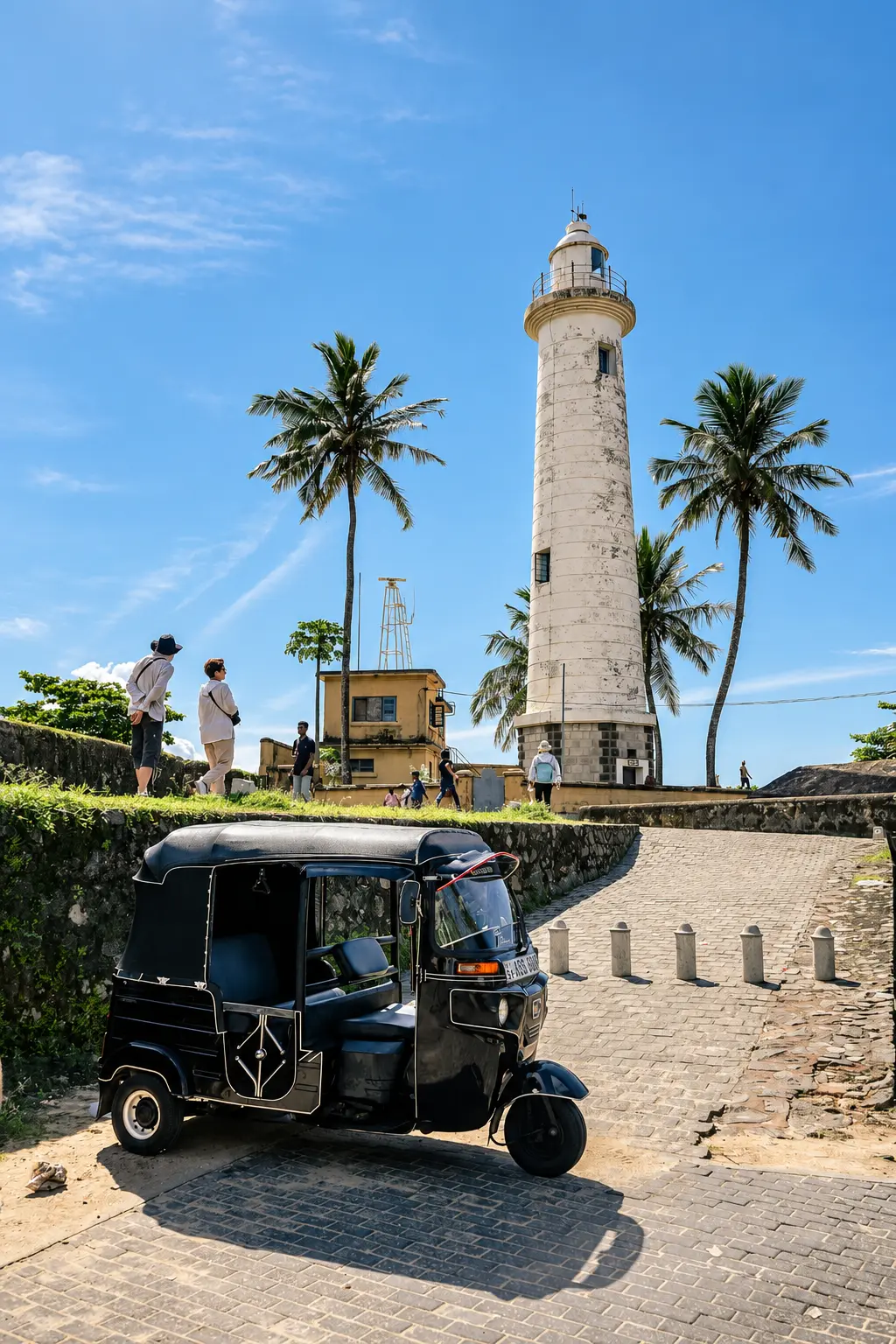
Explore Galle Lighthouse and Point Utrecht Bastion with practical guidance on lighthouse history, defensive architecture, photography, coastal safety and understanding one of Galle Fort’s most recognisable landmarks.
Location: Southern seaward edge of Galle Fort
Best for: Photography, maritime history and ocean views
Time needed: Around 30–60 minutes
Best time: Early morning or late afternoon
Entrance: Free to view from the public Fort area
White lighthouse above historic ocean ramparts
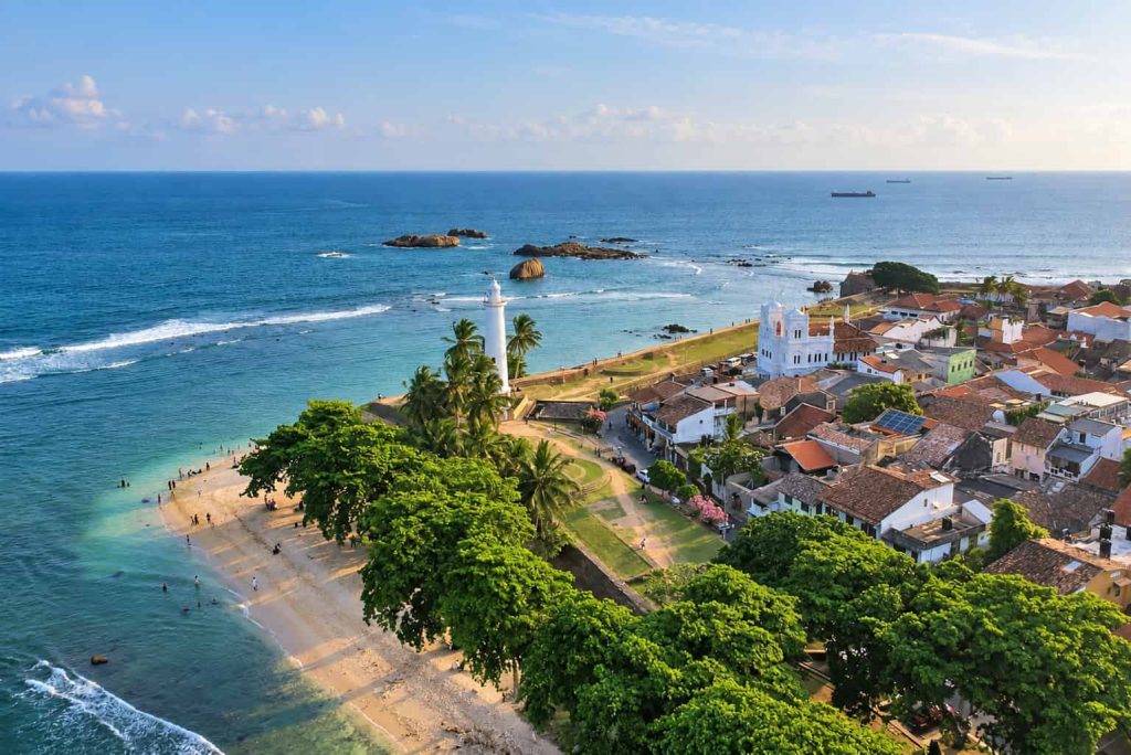
Understanding Galle Lighthouse Beyond the Photograph
Galle Lighthouse is one of Sri Lanka’s most recognisable coastal landmarks, but the white tower is only one part of the historic landscape around it.
It stands on the southern edge of Galle Fort beside Point Utrecht Bastion, where the fortified walls meet the Indian Ocean.
The location connects three important parts of Galle’s story: maritime navigation, harbour trade and military defence.
Instead of viewing the lighthouse as an isolated monument, look at how the tower, bastion, rocky shoreline and Fort walls occupy the same strategic coastal position.
Why Galle Needed a Lighthouse
Galle developed around an important natural harbour used by vessels travelling through the Indian Ocean.
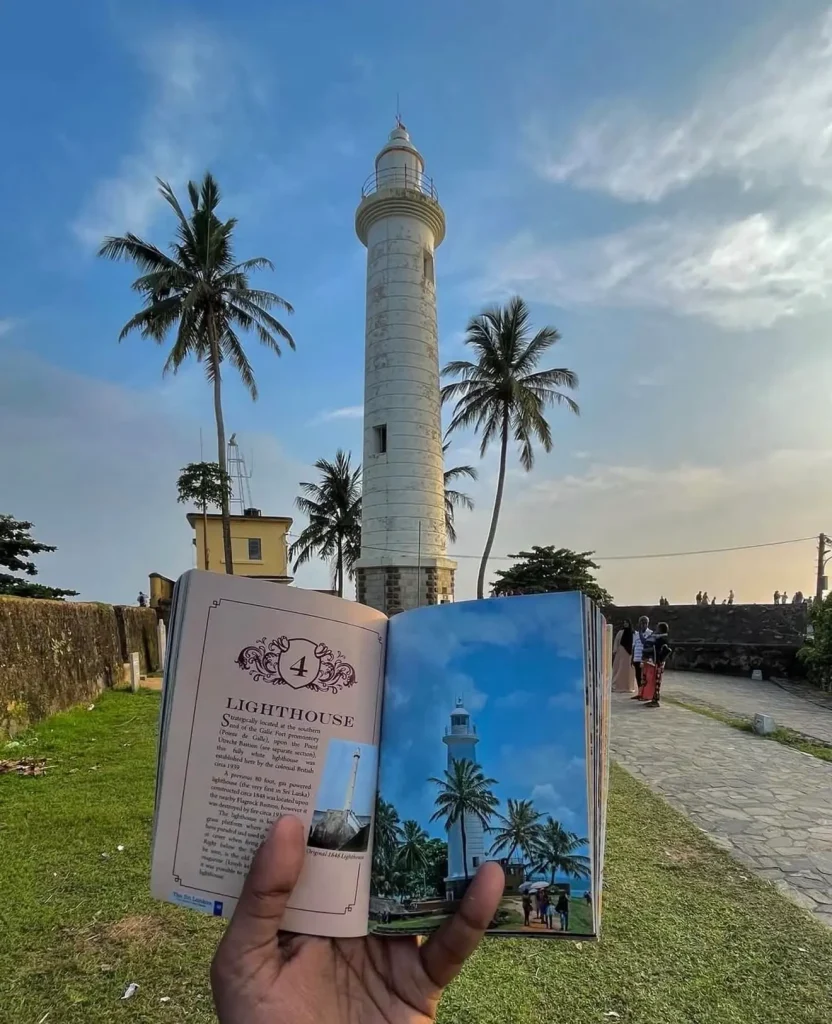
Photography: @ushan_rk/Instagram
For ships approaching the coast, reliable navigation became increasingly important as Galle developed as a major maritime and commercial centre.
The lighthouse tradition reflects that practical relationship between the Fort and the harbour.
The tower was never built simply as an architectural landmark. Its purpose was to help guide vessels approaching a busy and historically important port.
The Current Galle Lighthouse
The present lighthouse dates from 1939.
It replaced an earlier lighthouse that was destroyed by fire and continues the long navigation history associated with Galle Harbour.
The current tower remains operational, which is important when understanding why access differs from a museum or historic observation tower.
Its continuing maritime function gives the lighthouse a different character from many heritage structures within the Fort.
Can You Climb Galle Lighthouse?
General tourist entry to the lighthouse tower is not part of a normal visit.
Treat it as an operational exterior landmark rather than an observation tower you can climb.
This does not reduce the experience because the strongest views are actually from the surrounding ramparts and streets, where you can see the complete tower together with palms, fortifications and the ocean.
Trying to get immediately beside or inside the tower would remove much of the context that makes it so photogenic.
What Is Point Utrecht Bastion?
Point Utrecht is the fortified position beside the lighthouse on the southern seaward edge of Galle Fort.
The bastion belongs to the larger defensive system developed around the rocky peninsula.
Bastions projected from the walls so defenders could observe and protect adjoining sections of the fortification rather than leaving blind areas directly beneath the walls.
From Point Utrecht, the relationship between military architecture and the natural coastline is particularly easy to understand.
Why Point Utrecht Follows the Coastline
Galle Fort was not designed as a perfectly regular geometric fortress placed on flat land.
Its defensive walls were adapted to the shape of the rocky headland.
Point Utrecht demonstrates this particularly clearly because the wall, exposed rocks and ocean all form part of the same defensive landscape.
Look beyond the individual stonework and notice how the bastion controls views along the coast and across the sea.
The Utrecht Powder Magazine
Point Utrecht is also associated with a historic gunpowder magazine built into the fortifications.
Gunpowder magazines were designed to store the ammunition required for artillery positioned around the bastions.
The Utrecht powder magazine is currently accessible on request through the Galle Heritage Foundation rather than operating as a standard walk-in gallery.
Even without entering the magazine, knowing that ammunition storage formed part of the bastion helps explain how these fortifications functioned as military infrastructure rather than simply as scenic walls.
How the Bastion and Lighthouse Serve Different Purposes
The lighthouse and bastion stand beside one another but belong to different functional stories.
Point Utrecht was designed as part of the Fort’s defensive system.
The lighthouse belongs to Galle’s navigation and harbour history.
Seeing them together shows how the same strategic piece of coastline continued to matter even as military priorities changed and maritime navigation developed.
The Classic Lighthouse View
The adjacent rampart provides the classic view of Galle Lighthouse.
Move far enough away from the tower to include the Fort wall, palms and ocean rather than filling the entire frame with the lighthouse alone.
This wider composition explains where the tower stands and produces the distinctive Galle image most travellers recognise.
You do not need to queue for one exact photograph. Moving a short distance along the wall changes the relationship between the lighthouse, palm trees and sea.
Street-Level Views
The lighthouse also looks very different from the streets below the ramparts.
Street-level viewpoints reveal how closely it sits beside homes, religious buildings and everyday activity inside the Fort.
This is an important part of Galle’s character.
The lighthouse is not isolated on an empty headland; it rises from an inhabited historic town.
Views from the Seaward Ramparts
Moving farther along the seaward wall provides additional perspectives back towards the lighthouse.
From here, the tower becomes one element within a longer line of fortification rather than the sole subject.
These angles are particularly useful for showing the scale of the ramparts and how Point Utrecht fits into the larger defensive system.
Best Time for Photography
Early morning and late afternoon generally provide the most attractive light.
Morning has the advantage of cooler temperatures and quieter surroundings.
Later in the day, warmer light can bring more texture to the walls and stronger contrast between the white lighthouse and the sky.
Midday sun is harsher and can flatten both the pale tower and surrounding stonework.
Photography Around Residents and Worshippers
The lighthouse area remains part of a living neighbourhood.
People use the surrounding streets for homes, businesses and worship rather than as a permanent photography set.
Keep entrances and narrow paths clear, particularly when taking portraits.
Ask permission before photographing identifiable residents or worshippers closely.
Long staged photo sessions should never obstruct people simply trying to move through their neighbourhood.
Commercial Photography and Filming
Ordinary non-commercial photography by visitors within Galle Fort is not charged.
Commercial and professional photography or filming requires permission through the relevant heritage authorities.
Drone filming also requires the appropriate aviation approval in addition to heritage-site permissions.
Meeran Jumma Mosque
The white Meeran Jumma Mosque stands close to the lighthouse and adds another distinctive architectural element to this part of the Fort.
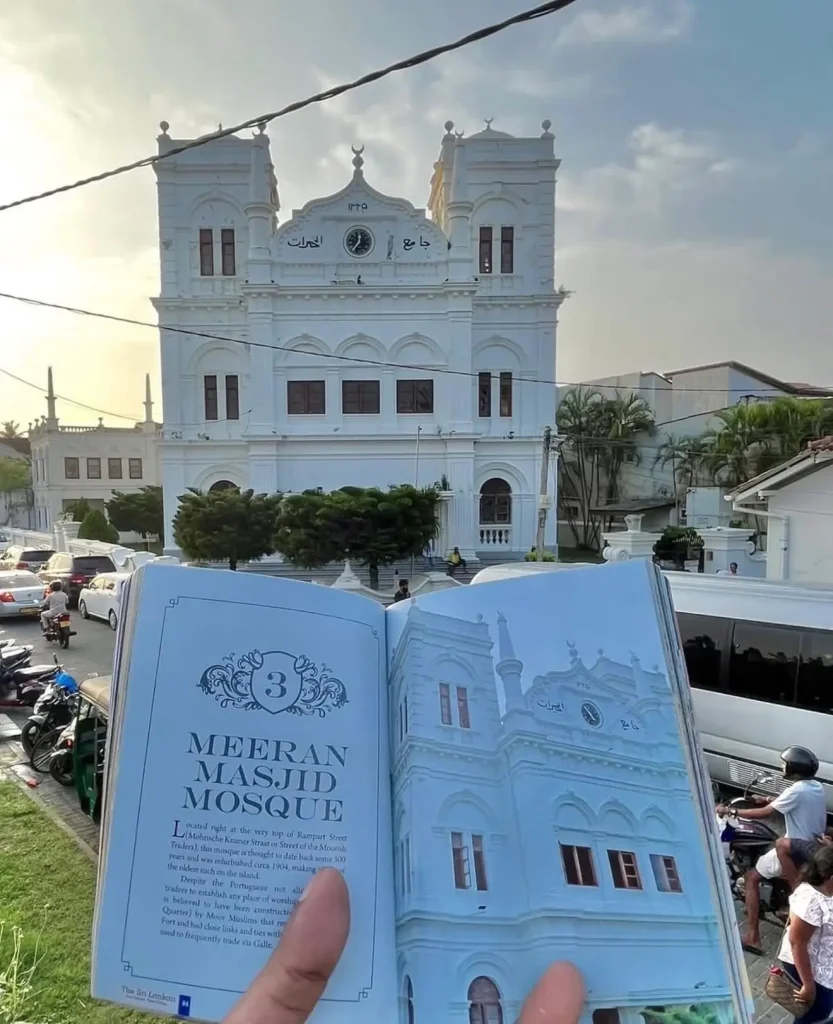
Photography: @ushan_rk/Instagram
It remains an active Muslim place of worship rather than simply a historic building.
Dress modestly, avoid interrupting prayer and ask respectfully before entering areas used for worship.
Do not photograph worshippers closely without permission.
The proximity of the mosque and lighthouse also illustrates the cultural diversity found within the inhabited Fort.
The Lighthouse and Galle’s Living Fort
One reason the lighthouse setting feels different from many isolated coastal monuments is that normal town life continues immediately behind the ramparts.
Homes, guesthouses, religious buildings, cafés and local businesses occupy the streets around the landmark.
This is part of the heritage value of Galle Fort: it remains a functioning urban settlement rather than an empty archaeological enclosure.
Visitors should therefore balance sightseeing with respect for the people who live inside the World Heritage area.
Coastal Weather
The southern ramparts are exposed directly to the Indian Ocean.
Bright sun, strong wind and sudden showers can all affect the lighthouse area.
Carry sun protection during clear weather and take additional care on wet stone after rain.
Sea spray can also reach exposed sections when conditions are rough.
Safety on the Ramparts
The historic walls were built for defence rather than modern visitor safety.
Some sections have exposed drops, uneven surfaces and edges without the type of barriers found at purpose-built viewpoints.
Stay comfortably back from edges and supervise children closely.
Do not climb onto narrow walls for photographs or move into exposed positions during strong wind or rain.
Do Not Treat the Water Below as a Swimming Spot
The rocky shoreline below the southern Fort walls can look inviting in calm weather.
However, sea conditions around exposed coastal walls can change quickly.
Waves, rocks and currents make an apparently calm section of water very different from a managed swimming beach.
Use recognised beaches elsewhere on the coast for swimming rather than entering the sea simply because access below the Fort appears possible.
Visiting with Children
The lighthouse is easy to appreciate with children because no long hike or museum visit is required.
The main concern is the exposed rampart environment.
Keep younger children beside you around drops, steps and wet stone.
Showing them how the bastions, harbour and lighthouse served different purposes can also make the historic setting easier to understand.
Accessibility
The lighthouse can be viewed without completing the entire elevated rampart circuit.
This makes it one of the easier major Galle Fort landmarks to appreciate for travellers with limited mobility.
Street-level views allow visitors to see the tower without negotiating every section of historic wall.
The surrounding streets can still contain uneven paving, kerbs and occasional steps, so move at a comfortable pace.
Is There an Entrance Fee?
No ticket is required simply to see Galle Lighthouse, Point Utrecht and the surrounding public ramparts.
The lighthouse exterior forms part of the public Fort landscape.
Separate charges apply only if you enter particular museums, heritage galleries or other ticketed attractions elsewhere within Galle Fort.
How Long Should You Spend Here?
Allow around 30–60 minutes if you want to appreciate the lighthouse, Point Utrecht and the immediate surroundings properly.
A quick photograph takes only a few minutes, but it misses much of what makes the location historically interesting.
Spend time looking in both directions along the walls and notice how the Fort, town and ocean fit together.
Why the Lighthouse Works Better in Context
Seeing only the white tower tells you very little about Galle.
Seeing it beside a Dutch-era bastion, working harbour landscape, rocky coastline and inhabited historic streets reveals much more.
The lighthouse represents navigation, Point Utrecht represents defence and the surrounding streets demonstrate the continuing life of the fortified town.
Those layers are what make this relatively small corner of Galle Fort so historically rich.
Is Galle Lighthouse Worth Visiting?
Yes. The lighthouse is visually striking, easy to reach and one of the clearest places to understand how Galle’s maritime and military histories overlap.
The current 1939 lighthouse, Point Utrecht Bastion, historic powder magazine, ocean-facing walls and surrounding living neighbourhood all occupy one compact section of the Fort.
Give the area enough time to understand those connections rather than visiting only to reproduce the familiar lighthouse photograph.